Tree Mapping in Downtown Portsmouth
Introduction to Tree-Mapping
In April 2015, Portsmouth, Ohio was named as a Tree City USA. Our city received this designation by meeting the requirements of having a tree department, a tree-care ordinance, an annual community forestry budget with a minimum of $2 per capita, and an annual Arbor Day celebration held at Tracy Park. These four resources point to Portsmouth’s pride and the priority that we place in nature preservation.
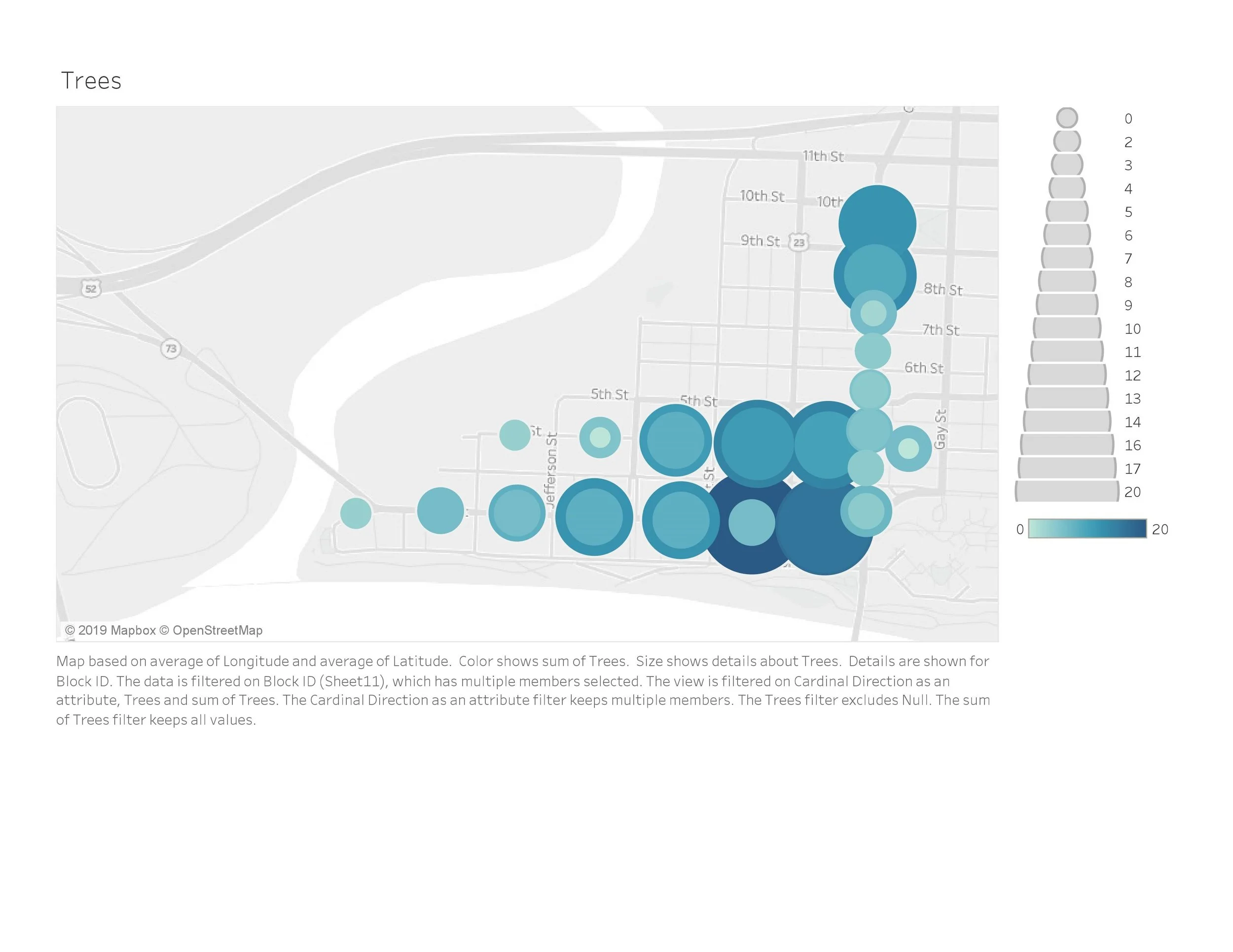
In addition, Shawnee State Faculty Dr. Erik Larson and Dr. Logan Minter have developed an interactive map, locating and identifying every tree on the SSU campus. Their project inspired us to find a way to geo-locate the trees in a grid in Downtown Portsmouth, from 10th and Gay Street to Alexandria Point.
What is the problem?
Getting this data typically requires a large amount of time and resources, with advanced GPS trackers that cost significant amounts of money. Or, with far less time required, a small team can get unreliable data that doesn’t include GPS coordinates, and can’t be used for any kind of spatial mapping. We knew there had to be a better way for community data projects, so we created one.
Our Solution to the Problem
The Block ID system contains GPS coordinates for each block, and for each side of the street, to more accurately identify the physical asset location. It also connects with the street addresses for each block, and the corresponding property Parcel ID’s. By connecting all of this data, teams of students can use their smart phone and an online form to submit the number of trees on each block, and it will automatically begin to fill in the map. By using the Block ID as an anchor point when collecting data, a project that would have taken weeks to effectively organize and implement, can now be completed in only hours and still return quality data.
This data can be used to keep an accurate inventory of the number and types of trees, and generate useful information for Dr. Larson and Dr. Minter's app. However, the project extends beyond trees, as it also serves as a pilot for a Block ID system, which enables community led data initiatives or student projects. This system encourages more data-enriched systems, and ultimately, data-driven decision making.
What’s more, the system organizes data collection while layering with the Property Parcel ID and Street address. This system allows us to use data in our day-to day lives in a more efficient manner, as a tool for communication and problem solving.
The Future of the Block ID System
The Block ID system makes future projects not only possible, but more efficient, and the goal is to encourage more data driven decision making. With the ODHE funding, we are seeking to create opportunities for student work that impacts our community. If you believe that better data can impact your organization or community project, please Contact Us.
You can find more information about Dr. Larson and Dr. Minter’s original research project here.

